geography
Features of the Lake and Topography
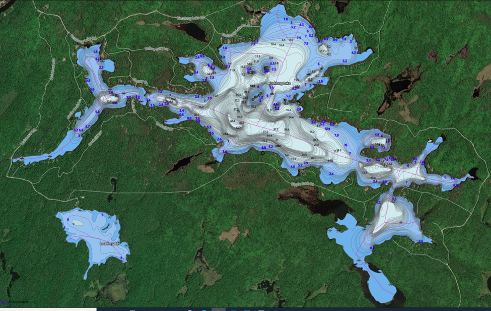
Koshlong Lake is a mid-sized, deep water lake located in the Haliburton Highlands. Most of the lake lies in the municipality of Highlands East, with only the north-western corner of Dysart Bay lying in the municipality of Dysart et al. Koshlong is fed by 18 surface streams recognized by the Ministry of the Environment. The primary inflow (at the east) and outflow (southwest) are through Koshlong Creek, which flows into the Burnt River, and in turn to the Kawartha lakes, the Otonabee River, and the Trent River to Lake Ontario. The outflow is controlled by a dam maintained by Parks Canada. The maximum depth is 43 metres, with a mean depth of 10.1 metres. Koshlong is considered a low nutrient (oligotrophic) lake, which has implications for water quality and wildlife. Learn more here. |
The lake covers approximately 4.8 square km in area. |
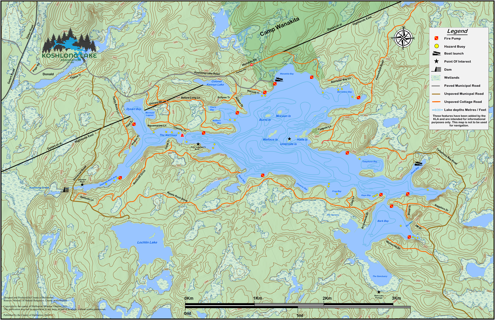
Click the image above to download a copy of the 2023 updated map | ACCESSBy road, properties on Koshlong can be reached from three main routes maintained by Highlands East and Dysart et al:
There are two public boat launch points:
|
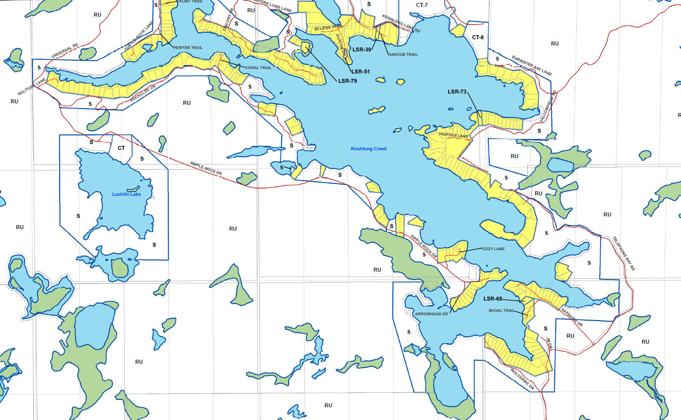
DevelopmentThere are 252 shoreline properties located on the 34 km perimeter of Koshlong Lake; 220 of these are privately owned, the remainder are associated with Camp Wanakita. The total developed area of the shoreline 60%, with the remaning 40% as undeveloped Crown Land. Koshlong is designated as an "at capacity" lake, meaning that the dissolved oxygen level in lake waters is just above the minimum level sufficient to support the fish population; sale and development of new shoreline properties would have an adverse effect and is therefore prohibited at this time. |
|
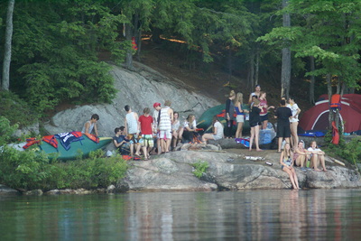
Koshlong has been home to camps for youth since 1938, when educator Alvin Kaye and his family opened Camp Lagakelo. In 1953, they sold the property to the Hamilton YMCA, and Camp Wanakita was formed. From the 1960s until 1988, Hockey Haven camp ran on property adjacent to Wanakita; it was also sold to the YMCA in 1988. Wanakita now operates two distinct year-round camps on the 1000 acres of property between Koshlong Lake and the Burnt River: an inclusive student camp, and family camp. The KLA is proud to partner with Wanakita on many social and environmental issues that impact our lake and community. |
|
- Home
- Environment
- Geography
Thanks to KLA member Rob Horsburgh for his photograph of Wallace Island used as the background photo throughout this site